
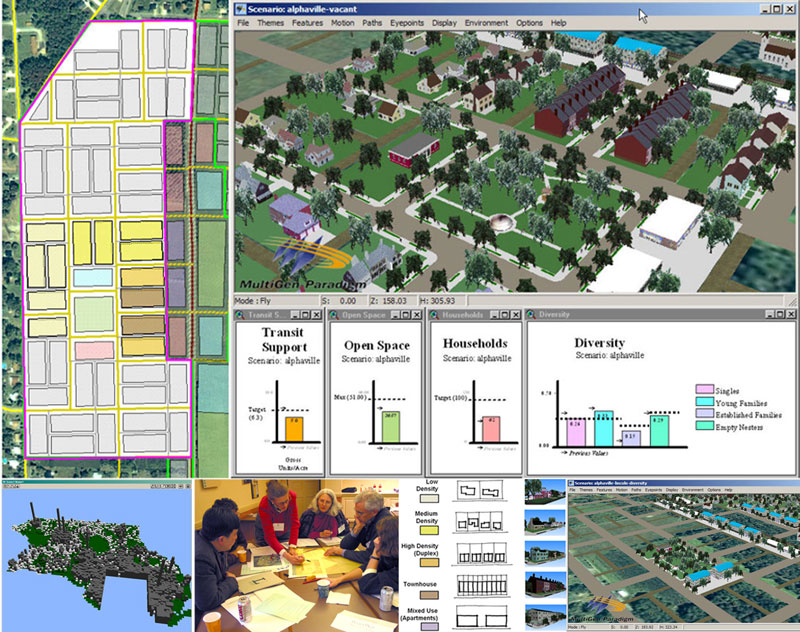
Visioning and Visualization Workshop
The Lincoln Institute of Land Policy, whose mission includes "integrating theory and practice to better shape land policy" and "improving the quality of debate and disseminating knowledge of critical issues in land policy," invited the Environmental Simulation Center and ACP Visioning and Planning to develop a workshop for professional planners on "Visioning and Visualization.
Prince George's County
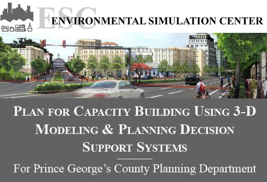
The Maryland-National Capital Park and Planning Commission (M-NCPPC) and the Prince George's County Planning Department, recognizing the value of 3D modeling and Planning Decision Support Systems (PDSS) as well as the challenges involved with institutionalizing the use of these tools in the county's planning process, issued an RFP for a "Plan for Capacity Building Using 3D & Modeling Applications"
South Kingstown
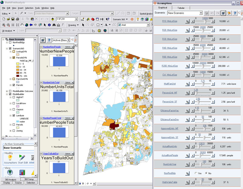
Houston - Performance, Tracking, and Allocation
Under a grant from the Transportation and Community and System Preservation (TCSP), the City of Houston engaged the ESC to develop a land development model and performance tracking system to monitor growth along the City's Main Street Corridor. The goals of the system were threefold: 1) provide a system that measures the performance of the corridor with regards to community goals and values; 2) track change as it occurs, and 3) allocate future-year growth to where it is likely to occur. The system, dubbed the Performance/ Tracking/Allocation (P/T/A) system, consists of two parts: the P/T/A Land Development Model and the P/T/A Performance Report Card.